Friday, April 19, 2024
Belo Horizonte Travel Guide - Travel S Helper

Belo Horizonte

travel guide

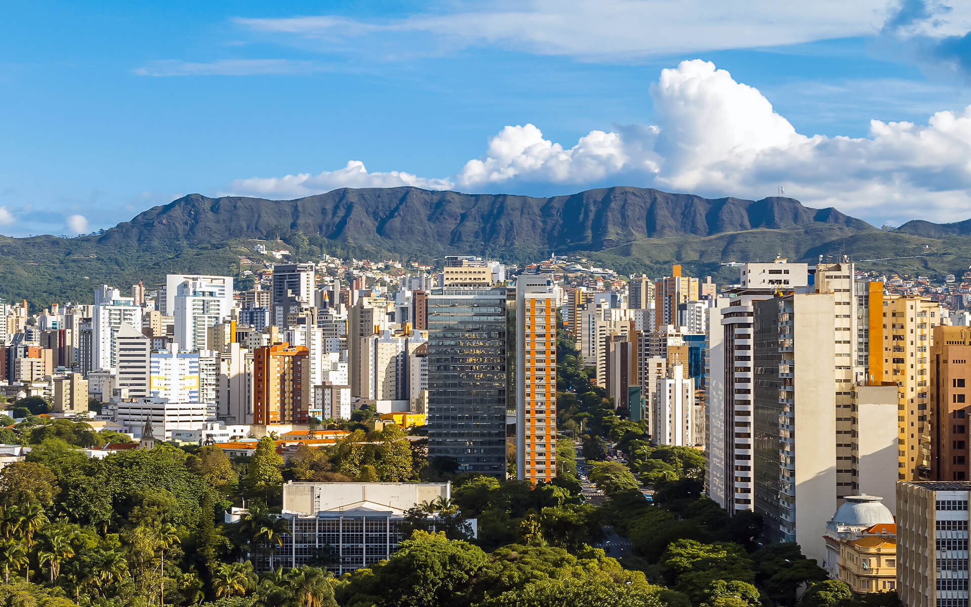
Belo Horizonte is Brazil’s sixth biggest city, South America’s thirteenth largest city, and the Americas’ eighteenth largest city. The city serves as the hub of the Belo Horizonte metropolitan region, which is the third most populated in Brazil and the seventeenth most populous in the Americas. Belo Horizonte is the capital of Minas Gerais, Brazil’s second largest state. It is Brazil’s first planned modern metropolis.

The area was initially occupied in the early 18th century, but the city as it is known today was planned and built in the 1890s to replace Ouro Preto as Minas Gerais’ capital. The city has a blend of modern and traditional architecture, and it is home to numerous modern Brazilian architectural landmarks, most notably the Pampulha Complex. Aaro Reis and Francisco Bicalho found inspiration for the city’s design in the urban planning of Washington, D.C. The city has implemented noteworthy projects in urban redevelopment and food security, for which it has received worldwide recognition.

The city is constructed on many hills and is bordered by mountains on all sides. There are numerous huge parks in Belo Horizonte’s local vicinity. The Mangabeiras Park (Parque das Mangabeiras), situated 6 kilometers (4 miles) south-east of the city center on the hills of Curral Ridge (Serra do Curral), offers a panoramic view of the city. It covers an area of 2.35 km2 (580 acres), with the natural woodland covering 0.9 km2 (220 acres). The Jambeiro Woods (Mata do Jambeiro) natural reserve has 912 hectares (2,250 acres) of Atlantic forest flora. The reserve is home to over a hundred different bird species, as well as 10 distinct animal species.

Belo Horizonte was a host city for both the 1950 and 2014 FIFA World Cups. In addition, the city co-hosted the 2013 FIFA Confederations Cup.

Flights & Hotels
search and compare

We compare room prices from 120 different hotel booking services (including Booking.com, Agoda, Hotel.com and others), enabling you to pick the most affordable offers that are not even listed on each service separately.

100% Best Price

The price for one and the same room can differ depending on the website you are using. Price comparison enables finding the best offer. Also, sometimes the same room can have a different availability status in another system.

No charge & No Fees

We don’t charge any commissions or extra fees from our customers and we cooperate only with proven and reliable companies.

Ratings and Reviews

We use TrustYou™, the smart semantic analysis system, to gather reviews from many booking services (including Booking.com, Agoda, Hotel.com and others), and calculate ratings based on all the reviews available online.

Discounts and Offers

We search for destinations through a large booking services database. This way we find the best discounts and offer them to you.

Belo Horizonte | Introduction

Belo Horizonte – Info Card

POPULATION : • Municipality 2,502,557
• Metro 5,156,217 (3rd)
FOUNDED :  Founded 1701
Incorporated (as city) December 12, 1897
TIME ZONE : • Time zone BRT (UTC−3)
• Summer (DST) BRST (UTC−2)
LANGUAGE :   Portuguese
RELIGION : Catholic 59.87%
Protestant 25.06%
No religion 8.02%
Spiritist 4.07%
AREA : • Municipality 330.9 km2 (127.8 sq mi)
• Urban 282.3 km2 (109.0 sq mi)
• Metro 9,459.1 km2 (3,652.2 sq mi)
ELEVATION :  760 m (2,490 ft)
COORDINATES :  19°55′S 43°56′W
SEX RATIO :  Male: 46.9%
 Female: 53.1%
ETHNIC : White people (46.7%), Pardo (Multiracial) people (41.9%), Black people (10.2%), Asian people (1.1%), Amerindian people (0.1%).
AREA CODE :  31
POSTAL CODE :  30000-000
DIALING CODE :   (+55) 31
WEBSITE :   Belo Horizonte

Tourism in Belo Horizonte

Belo Horizonte is the capital of the state of Minas Gerais and Brazil’s third biggest city. It’s a nice city with an organized grid design and tree-lined avenues. It’s a nice place to halt for visitors on their route to magnificent colonial villages like Ouro Preto and Tiradentes.

Climate of Belo Horizonte

Belo Horizonte is located in the tropical zone, with a latitude of 19’55” South. The annual temperature ranges from 9 and 35 °C (48 and 95 °F). The region’s Köppen climatic classification is tropical savanna climate (Aw), with humid subtropical climate (Cwa), (tropical at high elevations, humid/warm summers, and dry/mild winters). Belo Horizonte is around 300 kilometers (190 miles) from the coastline.

Even while inter-seasonal changes are not as prominent as in temperate areas, there is a distinction between spring and summer, as well as autumn and winter. July is often the coldest month, with the lowest recorded temperature of 2 °C (36 °F). January is often the warmest month, with the maximum recorded temperature of 37.4 °C (99 °F).

Belo Horizonte’s 852-metre (2,795-foot) elevation aids in cooling the city by reducing the high maximum air temperatures observed in adjacent towns at lower elevations. The weather in Belo Horizonte is pleasant all year. Temperatures range from 11 to 31 °C (52 to 88 °F), with an average of 22 °C (72 °F). Winters are dry and mainly sunny, while summers are wet.

Geography of Belo Horizonte

Belmopan lies 50 miles (80 kilometers) inland from the Caribbean and 76 meters (249 feet) above sea level, with views of the Mountain Pine Ridge foothills. (At night, the weather is lovely.) The city is accessible through the Hummingbird Highway. The Cockscomb Basin Wildlife Sanctuary is two and a half hours by vehicle south of Belmopan. It is served by the Hector Silva Airstrip.

Economy of Belo Horizonte

From its inception until its demise, Belmopan was overseen by the RECONDEV (Reconstruction and Development Corporation), which reported to the government.

Because Belmopan is the capital, many of its people work in administrative or technical capacity for the national government. Many of them are located in the massive cluster of government buildings that surrounds the National Assembly.

Belmopan is home to around 589 enterprises (the 1997 census revealed the presence of 373). In the city, there are five foreign banks, as well as several local financial institutions. A bus station and market complex were erected in 2003.

In compliance with zoning limitations, Belmopan has set aside around 200 acres (81 hectares) of land inside municipal borders, mostly in one-acre (4,000 m2) parcels. While the city presently has little industrial activity, the council has undertaken a push to attract both local and foreign investment. A 100-acre (40-hectare) industrial park is being built near the municipal airstrip, which has a paved 1,100-meter runway but no control tower or hangars.

Asia

Africa

South America

Europe

North America

Read Next

Quebec City

Quebec City is the capital of Quebec, a Canadian province. Quebec City’s Old Town, perched on cliffs overlooking the St. Lawrence Seaway, is a...

Comoros

The Comoros, formally the Union of the Comoros, is a sovereign archipelago island country in the Indian Ocean located at the northern end of...

Ceske Budejovice

In the Czech Republic, České Budějovice is a statutory city. It is the biggest city in South Bohemia, as well as the region’s political...

Austin

Austin is the capital of the United States’ state of Texas and the county headquarters of Travis County. Austin is the 11th most populous...

Latvia

Latvia, formally the Republic of Latvia, is a nation located in Northern Europe’s Baltic area. It is one of three Baltic states. It is...

Oberstdorf

Oberstdorf ski resort is located on the German-Austrian border. Oberstdorf, a huge, scenic, cosmopolitan but surprisingly little-known Bavarian resort, and the Austrian district of...